How much rain does it take to cause a landslide?
A new study on thresholds for rainfall induced landslides published in Water Resources Research investigates the predictability of landsliding from daily gridded precipitation data and a cross-country landslide inventory in Switzerland.
Landslides belong to one of the most impacting natural hazards in alpine landscapes with a high frequency of occurrence and significant economic losses. One of the possible approaches to deal with this issue is that of probabilistic/empirical approaches based on historical records.
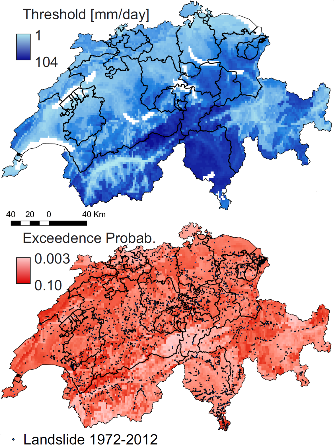
Here a high-resolution gridded daily precipitation dataset was combined with a landslide inventory containing over 2000 events in the period 1972-2012 to analyze rainfall thresholds that lead to landsliding in Switzerland. Because of the nature of the precipitation dataset, we were able to consider the local precipitation instead of choosing a representative raingauge and therefore design a robust method for the definition of thresholds. This was done using statistical measures which not only maximize the correct predictions but also consider false alarms.
In addition, the large number of landslides available and the temporal coverage of the two databases enable us to address informational content of external parameters by localizing the threshold, defined for sub-regions of the country according to local climate and erodibility. Results showed that the amount of precipitation required to initiate a landslide increases with increasing wetness (mean daily precipitation) and decreasing erodibility.
Extensive verification and validation of the robustness of the method, often lacking in previous studies, was also carried out.
Leonarduzzi, E., P. Molnar, and B. W. McArdell (2017), external pagePredictive performance of rainfall thresholds for shallow landslides in Switzerland from gridded daily data, Water Resour. Res., 53, doi: external page10.1002/2017WR021044.